Tuesday, May 26, 2015

Newark Slough 2015-05-25

Located off Thornton Road and by Hwy 84, Newark slough is part of the Don Edwards San Francisco Bay National Wildlife Refuge. I'd mentioned in the blog on Day 7 that I will return to this spot - and it happened to be today.

Newark slough trail is a 5 mile loop that takes you close to the Dumbarton bridge and is bordered by the slough almost all the way. You can reach the trail from the parking lot taking the Tidelands trail and walking across a boardwalk. 


It was cloudy this morning, with a cool breeze and the temperature in low 60s. Perfect for walking this completely exposed trail. Newark slough trail is a dirt trail that is constructed on levees bordering wetlands being restored from erstwhile salt ponds. There is ample evidence of salt ponds along the way, though.


We went round the loop in an anticlockwise direction. For more than a mile, you will have Coyote Hills Regional Park on your right and Dumbarton bridge ahead. After the two mile marker, the trail turns left and heads in an easterly direction.
Black-necked Stilt


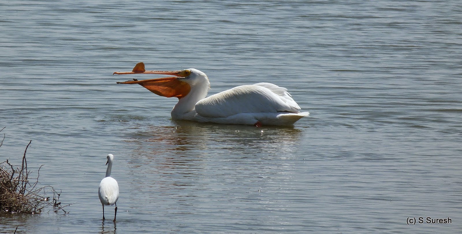
I was expecting to see lot of shore birds, but could see only mallards, gulls, american avocets and black-necked stilts today. 


American Avocet
After the three mile marker, the trail turns north, subsequently west and takes you to the spot where you started from. After completing the large 5 mile loop, Jaya, who accompanied me today and I decided to also complete the Tidelands trail.

Tidelands trail goes around the hill providing a variation from the slough trail that is by the marshlands. Much shorter, the less than two mile loop by tidelands trail allows dogs.


We completed the nearly 7 mile hike in little over two hours. Here are few more pictures from the hike.
#SFBayTrail #BayTrail #NewarkSlough 


Saturday, May 2, 2015

Day 7: 2015-05-02 Mountain View - Alviso

Home stretch! 

All that was needed to complete my planned walkabout was a 17 mile "day trip". I started day 7 at Mountain View, picking up the bay trail at Crittenden Ln and making my way towards Sunnyvale. This was the place I made a mistake on day 1, so I was absolutely sure where I was going today.


Beautiful Snowy Egret
It was cloudy and slightly chill at around 50 degrees this morning. The sun didn't bother me for a while as I headed eastward in Moffett bay trail. For the first two miles, the trail is bordered by water/slough on both sides. There were plenty of shorebirds and waterfowl in this area.

Over the next three miles, the trail will meander with NASA, Lockheed Martin & Sunnyvale Waste Water treatment plants on one side and water on the other. All through thus far and for the next two more miles, the hike is on a dirt trail, built on a levee. 

After passing the sports complex on the right, the trail enters Baylands park and for about a mile or so, will be a paved. I continued on Gold St connector, Gold St, Elizabeth St and Hope St to reach the Alviso Marina County Park. 


Expansive Alviso Slough Scenery


Alviso is a community in San Jose by the wetlands and the park is the staging area for a 9 mile loop around the Alviso slough. Alviso slough is a unique experience. 9 miles of trail built on levees with water all around you is absolutely one of a kind and a fitting end to my hike. 


American White Pelican
If you are a bird watcher, Alviso slough as well as Moffett bay trail will be a treat. I saw a variety of waterfowl, shorebirds, herons, pelicans and more today. An adult American White Pelican feeding was the highlight of the day.

And so, some 6+ hours and 17+ miles later, I completed the SF bay walkabout. While I was happy that I completed the ~150 mile hike in 7 days, it left me somewhat empty...  Walking for 8+ hours, I found myself being in the moment and not thinking about anything else for long periods... Just focusing on what I was seeing, hearing and experiencing. This is the closest I've come to what could be characterized a meditative experience. 

I do plan to go back to places that I couldn't fully experience. The 5 mile loop around Newark slough & the 6 mile loop around Bay Farm island (where Oakland airport is located) are on top of the list. If and when I do those sections, I'll add on to the blog. SF bay trail continues in 5 more counties further north. May be, I'll take them on too.

Key Stats from Day 7


  • Distance covered: 17 miles
  • Elapsed time: 6 hours 30 minutes (including breaks)
  • Breaks: About 20 minutes
  • Cities: Mountain View, Sunnyvale, Alviso (San Jose)
  • Dog friendly segments: Bay trail in Sunnyvale (portions of Moffett Bay Trail)
  • Birds observed: Willets, Black-necked stilts, Mallards, Great Egrets, Snowy Egrets, American White Pelicans, Western Gulls, Ravens and Double Crested Cormorants
Cumulative Stats
  • Covered 145 miles
  • In 7 days, an average of nearly 21 miles per day
  • Across 4 counties - Santa Clara, San Mateo, Alameda and San Francisco
  • Walking on an average 7 hours 20 minutes each day

Pictures (60+) from the hike today. Complete map of the 7 day walkabout.